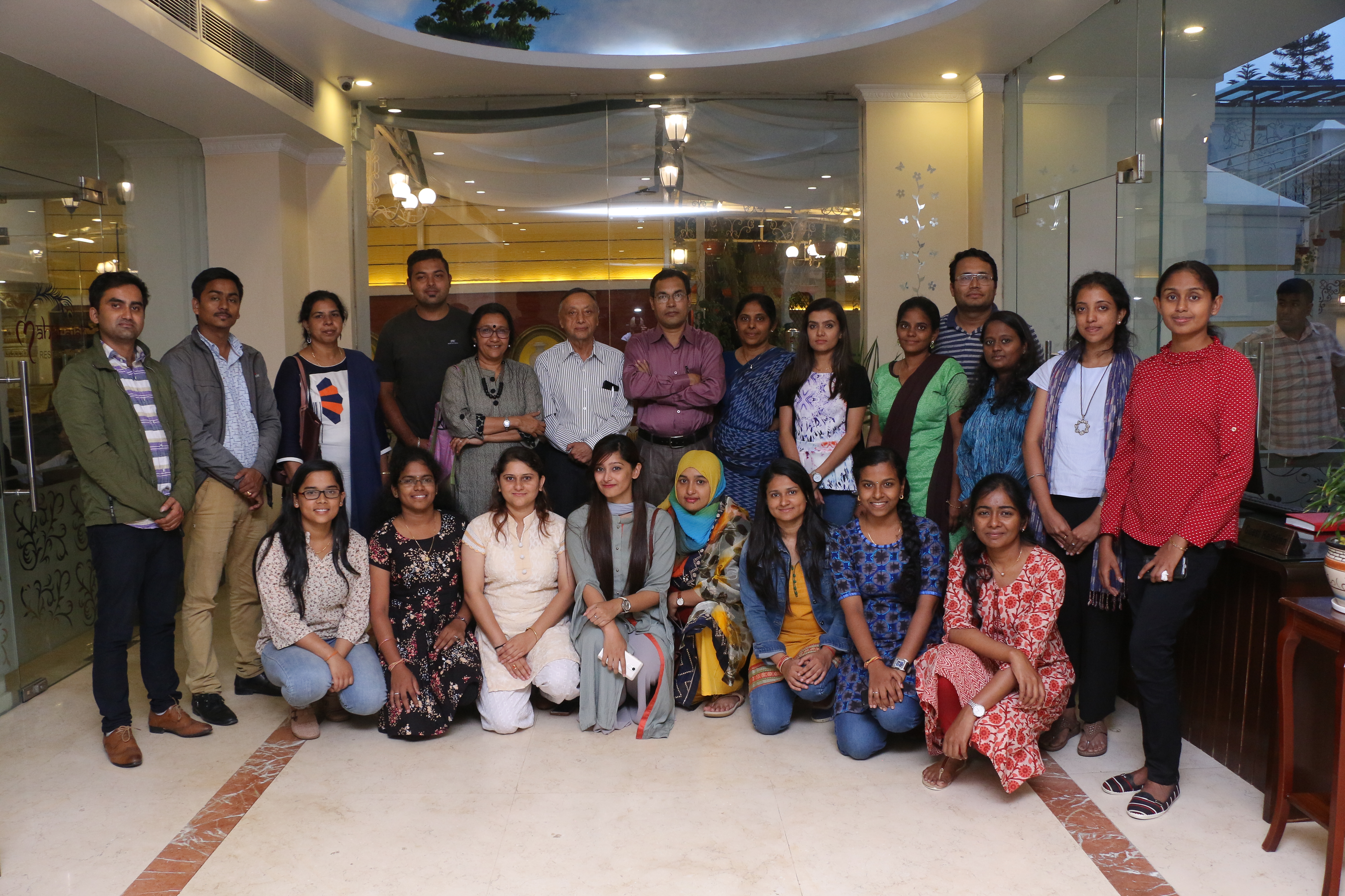
Virtual Regional Training cum Workshop on Interdisciplinary Field Research Methods and Gender and Water under its South Asian Water (SAWA) Leadership Programme on Climate Change (29th Sept-29th Oct 2020)
Please Register at: http://www.saciwaters.org/sawatot/ To receive the Zoom Link of the Series
SaciWATERs with support from IDRC and Cap-Net, is organising a Virtual Regional Training cum Workshop Program in ‘Inter-Disciplinary Field Research Methods’ and ‘Gender and Water’ from 29th September to 29th October 2020. This training program will be conducted for the faculty and SAWA awardees of Engineering Institutes from India, Bangladesh, Nepal and Sri Lanka. It will have 10 modules (2 modules per week) with interactive lectures hosted in an online platform. This training program aims to provide multidisciplinary insights to the engineering faculty and post-graduate students (SAWA Awardees) from universities to ensure a greater degree of interdisciplinary element in the IWRM research.
Brochure
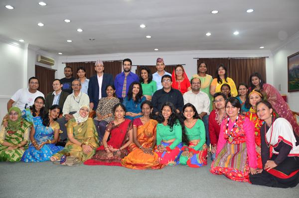
SAWA Regional Workshop on 'Leadership and Research Methods for Interdisciplinary Water Research'
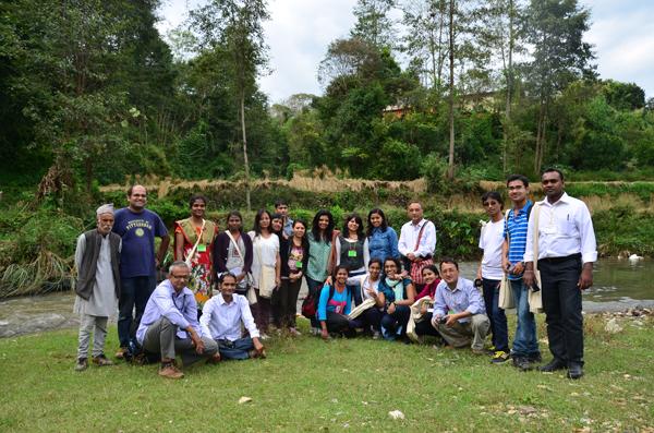
SaciWATERs in partnership with Nepal Engineering College (NEC) organised a workshop on ‘Leadership and research methods for interdisciplinary water research’ from 24 August to 5 September 2018 in Nepal. It was conceptualized under the ‘South Asian Water (SAWA) Leadership Program on Climate Change’ a leadership program that awards fellowships to women pursuing Masters in Integrated Water Resources Management (IWRM) in south Asia. The training was co- funded by IDRC and CapNet. The participants of the workshop were the fellowship awardees from four south Asian countries and the program coordinators. The aim of this workshop was to impart training to the SAWA students in the areas of leadership building, climate change, gender, theoretical and methodological frameworks for interdisciplinary water research. In order to acheive this, there were three phases of the workshop. The first was lectures and practical exercises on interdiscplinarity, climate change, gender, and methodological approaches all of which were delivered by experts from the relevant fields. The second was field exercise where, the participants applied classroom learning in the field, with a three day field trip to Bhotechaur village, in Sindhupalchowk district of Nepal. The students were divided into three groups and they worked on three themes, which are: Gender roles in accessing and managing common property resources; Role of women in agriculture as a result of male-selective outmigration and; Climate change perceptions. Through the field trip the students received hands-on training of qualitative and quantitative research methods. Thirdly, the students were trained in both quantiative and qualitative data analysis. This was followed by presentations on the last day of the workshop where the three teams made a presentation of their work and were evaluated by external evaluators on the basis of their conceptual understanding and application of interdisciplinary research methods, and gender lens.
.JPG)
.JPG)
Training Programme on Inclusive, Gender and Justice Approaches in Water-Based Livelihoods. April 23-27, 2014
Utthan, an independent NGO with more than 30 years of experience working with marginalized populations in four districts of Gujarat, with the support of SCaN held a training programme on 'Inclusive, Gender & Justice Approaches in Water-Based Livelihoods' in Bhavnagar, Gujarat from April 23-27 2014. The training brought together development sector professionals and activists from Bangladesh, Nepal and across India to raise their awareness and hone their practical skills on challenges to inclusive development in the water-based livelihoods sector. It imparted an analytical framework as well as strategies for integrating broad-based gender, religious and socio-economic equity through democratic mechanisms to ensure the sustainability of water-based livelihoods among vulnerable populations. The trainees completed modules on gender equality, sustainability and democratization, institution building, common property resources, project management, and appropriate technology for inclusive development. Field visits to three villages , role-play games, and case study analysis were used to reinforce the messages of the training. Training facilitators included Mr. Shalabh Mittal of the Entrepreneurship Development Institute of India, Ms. Seema Kulkarni of SOPPECOM, and Ms. Nafisa Barot of Utthan. Please contact utthan.ahmedabad@gmail.com for more information about the training.
Launching Workshop to develop a Training Manual on the Impact of Climate Variability in South Asia. February 18th and 19th 2014
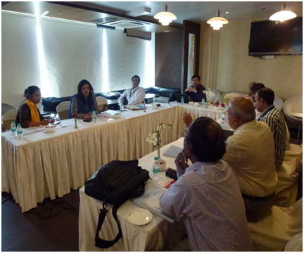
SCaN in association with the Institute for Resource Analysis and Policy (IRAP)India and Cap-Net UNDP organised the launching workshop for the preparation of a training manual on ‘Climate Variability and Impacts on Water, Energy and Food Security in South Asia’ which was held in Hyderabad, India on the 18th and 19th of February 2014.
The objectives of the workshop were to create a South Asia level platform for informed debate on the ways to reduce the vulnerability of the region’s water, energy and food systems to the impacts of climate variability and synthesising multi level information into a training manual.
The workshop comprised a task group of 10 participants, 6 of whom were experts from different disciplines of the field of water and who were high level professionals. There were 5 representatives from IRAP, 3 from SaciWATERs and 2 international participants representing South Asia region of Nepal and Sri Lanka.
The content of the workshop explored the existing literature, principles, concepts, philosophies and issues relating to Climate Variability globally, but focussed its debate and discussions on Climate Variability in the South Asian region especially the gaps in information available in the literature. The three main areas of debate were:
- How climate variability impacts on water resources and the manner in which they affect the water, energy and food systems in the region;
- Their impact on the socio-economic systems, particularly the poor and the vulnerable sections (vis-à-vis water security, food and nutritional security, livelihood security and health); and
- The adaptive water management approaches in the larger framework of integrated water resources management that would mitigate these impacts.
The gaps identified and discussion generated in the workshop was condensed into an informal task list. The experts who attended the workshop would carry out location studies in their respective countries to fill these gaps, and write papers. These papers will feed into the development of modules. The training manual is expected to be used in one of the forthcoming training programmes, to be organized by IRAP-SaciWATERs in collaboration with WALAMTARI, Hyderabad.
A compendium of already synthesised material will be submitted to Cap-Net.
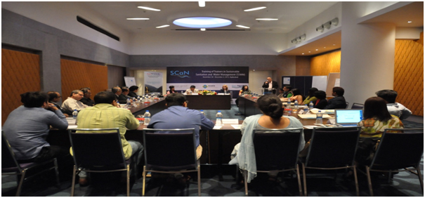
Training of Trainers Workshop on “Sustainable Sanitation and Water Management” (November 30th to December 4th 2013)
As part of SCaN‘s annual activities for the year 2013, an international training programme was organised in Hyderabad, India between the 30th of November and the 4th of December 2013. The training programme was a Training of Trainers in “Sustainable Sanitation and Water Management (SSWM)”. The training programme was conducted by SCaN in association with Cap-Net UNDP and Seecon ghmb.
The objectives of the programme were to 1) Understand the underlying principles and philosophy of SSWM 2) To know what SSWM implementation tools exist and how to apply some of them. 3) To know what SSWM planning tools exist and how to apply them. 4) To use the SSWM toolbox as a support for Training, Planning and Implementation. 5) To increase coordination and networking among relevant sectors and ministries.
The training programme targeted twenty five water and sanitation professionals from Asian countries. Participants spanned interdisciplinary fields within water and sanitation and the program drew representation from the Government, Academia, Civil Society Organisations, NGOs, The Private Sector.
The content of the workshop explored the existing principles, concepts, philosophies and issues in Water and Sanitation in the context of Sustainable Sanitation and Water Management and its integration into a SSWM toolbox. Further the training programme gave the participants planning and implementation tools to conduct their own training programmes in the future. Theoretical material discussed was then applied to group work using real world examples and in a field experience on Day 3 of the training. The sessions were interactive in nature, involving a lot of participation and group work/presentations. Participants got the chance to apply classroom learning in the field, with one field trip during the programme, to Katapur village in the Warangal district of Andhra Pradesh, where, participants saw the implementation of water and sanitation tools at the ground level.
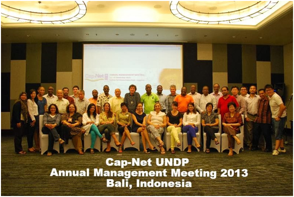
Cap-Net UNDP Annual Management Meeting - 11 to 15 November 2013, Bali, Indonesia
SCaN Network Manager, Dr. Neena Rao, attended the Cap-Net Annual Meeting 2013 in Bali, Indonesia. The main agenda for this meeting was to discuss ways for strengthening networks and fostering partnerships.
Two presentations were made by Dr. Neena Rao at the Annual Cap-Net meeting on the following topics:
Water Diplomacy
Why Water Diplomacy is the need of the hour, how it is a logical progression of water leadership and its practical applications in dealing with trans-boundary issues and as a tool in IWRM.
SDG Targets and Cap-Net
The targets for 2030 are discussed with reference to:
- Access to Water and Sanitation
- Sustainability
- Water disposal and its reuse
- The importance and role of capacity building activities in realising these targets
During this meeting results of the Network Peer Review were also discussed. SCaN was recognized as one of the Strongest Networks globally and the strongest network in the region. Malaysian Network Managers who had visited Hyderabad for the peer review of the network appreciated the work of SCaN during the meeting. They suggested that SCaN could help others in the Asian continent to strengthen their networks by working collaboratively. As a result of this discussion an Asia Network platform was formed during this meeting.
SDG Targets and CapNet|
Bali Water Diplomacy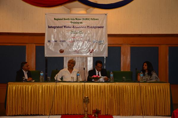
SAWA Training workshop, Kathmandu, October 3-8, 2013
SaciWATERs in association with its partner institutions in Bangladesh, India, Nepal and Sri Lanka conducted a 6 day training program in Kathmandu, Nepal, the first of the IDRC-SAWA fellowship training series. The training programme had 25 Postgraduate students from the four partner institutions participating and was funded by IDRC and Cap-Net.
South Asia’s agricultural economies are vulnerable to extreme environmental events. Better management of water and other natural resources is fundamental to the development of the region. Climate variability and change, food insecurity, population growth and urbanization have intensified environmental disasters in the recent past. Poor land and water resource allocation, utilization and pollution have robbed the poor, particularly women, of livelihood and dignity. Such broad, yet closely linked issues can only be effectively tackled through a holistic interdisciplinary approach. The fellowship seeks to address these issues, by providing the opportunity to train a generation of water professionals to tackle water issues using multi-disciplinary approaches that are sensitive to women, the poor, environment and sustainability.
Experts Workshop on Capacity Development, UNESCO-IHE, Delft: May27-28, 2013
During the expert workshop on knowledge and capacity development the following topics were discussed:
- Strengthening leadership abilities of water professionals
- How to foster locally driven capacity development
- How to enhance capacity development to effectively address nexus issues
- Make the business case for capacity development
- How to arrive at a coherent national strategy for capacity development in water sector
This programme was funded by UNESCO-IHE, Cap-NeT and ADB. Neena Rao along with three other network managers namely, Lilliana, Damian and Jacob from Central America were nominated by Cap-Net head office for this workshop.
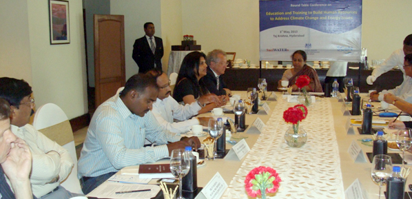
Round Table to create awareness and build human resources to address Climate Change, Water and Energy Issues, May 3, 2013
SaciWaters in association with British Deputy High Commission, Hyderabad, AP organised a Round Table Conference on “Building human resources to address Climate and Energy Issues” at Taj Krishna. The Sir David King, the Former Chief Scientific Advisor and Head of the Government Office of Science (2000-07) for UK Government was the Chief Guest and the Key Note Speaker. Currently, he is the Director of Research in Cambridge University and Senior Scientific Advisor to the bank UBS.
Given the background on issues concerning growth, climate change and energy in India, it is necessary to embed climate change and energy topics in the education system and develop a pool of technology experts, researchers as well as Practitioners in this domain. This will enable to develop a pool of technology experts, researchers as well as Practitioners who can contribute to promote the cause of low carbon growth. In view of this the round table was organised with the aim to:
- To understand how and where we stand today in terms of imparting quality education and technical training in issues like climate change, renewable energy in the state of Andhra Pradesh
- Deliberate on how do we move forward towards mainstreaming climate and energy issues through education, training and skills development?
- To understand the current policy initiatives in terms of education and required reforms.
Various heads of Academic Institutions such as the province Chancellor of Hyderabad Central University, Dean of Jawaharlal Nehru University, Dean Of Administrative Staff College of India, Director, Tata Institute of Social sciences and other Heads of Civil Society organizations and Other academicians attended this Round table Conference. As a result of this these academic Institutions have become aware of the capacity building activities of CapNET Network and have applied for ScAN membership.
Capacity Development Symposium, Delft, Netherlands, May 29-31, 2013
The Capacity Development Symposiumorganized by UNESCO IHE, ADB and CapNETfocusedon leadership in knowledge and capacity development across sectors, disciplines and other boundaries to improve efficiency and effectiveness of our systems. The symposium also meant to contribute to the ongoing discussion concerning the development of a new set of goals called sustainable development goals beyond 2015 for the water and sanitation sector. During this Symposium DrNeena Rao gave a presentation in the session on South – South Cooperation in Asia Pacific Region along with MrRavi Narayanan, Chair, Asia Pacific Water Forum and MrAnshuman, TERRI, India and also participated in a panel discussion post the presentation.
Strengthening Governance Capacities to Overcome Mismanagement and Corruption in the Water Sector - session 5
This session on the 29th of May, focused on strengthening capacities to improve governance in the water sector. It looked at examples of how the water sector can better address mismanagement and corruption through improving capacities on transparency, accountability and participation. The session presented relevant cases and discussions on how to strengthen capacities on transparency, accountability and participation. It aimed to identify barriers to strengthen capacities in governance and come up with concrete ideas on how some of these barriers can be overcome. Discussion was also held to identify ways of how capacity development opportunities can be replicated and scaled-up around the world.
DrNeena Rao, ScANwas also part of the panel discussion during the session on ‘Strengthening Governance Capacities to Overcome Mismanagement and Corruption in the Water Sector along with AmelAzeb, Egypt, Damian Indij, Argentina and HakkanTropp UNDP Water Governance Facility.
Download Presentation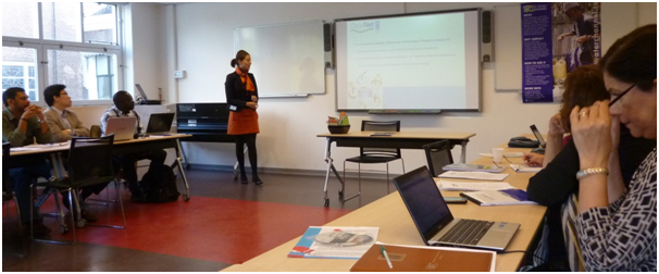
Cap-Net Network Managers Training Programme June 3-5, 2013
There was a Cap-Net training programme for network managers from From June 3rd to June 5th, 2013 which was attended by all the network managers from South Asia.
Water Integrity Forum, Delft, Netherlands, June 5 -7, 2013
To address the need for extending the base and increasing the pace of water integrity action, the Water Integrity Network, Water Governance Centre and UNESCO IHE came together to organize the first Water Integrity Forum in Netherlands at UNESCO IHE from 5th-7th June 2013. It had series of presentations and panel discussions during these three days in which Dr. Neena Rao, SCaN made a presentation on Integrity issues in Hydropower Development in the North East of India and also took part in two panel discussions on issues of Governance in Water sector.
Download PresentationTraining Programme on n Climate Variability and Water Insecurity Feb 24- March 1, 2013.
Climate change has now become one of the developmental challenges for nations across the developing world. Scientific studies have established significant impacts of a potential change in climate on the natural resources and concomitantly on the lives and livelihoods of people. It is often quoted that such impacts will be more on people in the developing countries due to their heavy dependence on the natural resource base and lower resilience to environmental shocks. The poor are more vulnerable to such changes.
Dr. Neena Rao's election as the Board Member on Cap-Net Network Governing Board November 2012
SCaN South Asia Coordinator Dr. Neena Rao was elected as the Board Member on Cap-Net Network Governing Board during the CapNet Global Networks Annual Meeting in November, 2012 in Costarica. She attended the first Board meeting in Delft, Netherlands on December 7th 2012
SCaN South Asia Coordinator Dr. Neena Rao was selected to be a part of the working group for “Engagement with Private Sector”
SCaN to contribute to Training Material on IWRM Approaches in Drought Risk Management
Prof. N Shantha Mohan, School of Social Sciences at the National Institute of Advanced Studies (NIAS) has been nominated by SCaN to contribute to the training material.
SCaN’s representation at 6th World Water Forum, Marseille, France, 12-17 March 2012
Dr. Jayati Chourey, Network Manager-SCaN participated in the preconference organised by the Women for Water Partnership (WfWP) within the framework of the Women Initiative at the 6th WWForum Marseille, France. A presentation on the ‘Capacity Building Initiatives for Women Water Professionals in South Asia’ was made by her, where she shared SaciWATERs’ and SCaN’s initiatives for mainstreaming gender in the water sector.
SCaN members selected for ToT on Integrated Urban Flood Management, Bangkok, 5-9 March 2012
Dr. Muhammad Munir Babar (Professor, Institute of Irrigation and Drainage Engineering, Mehran University of Engineering and Technology, Jamshoro, Sindh, Pakistan), Engr. Shamim Memon (Assistant Professor, Department of Irrigation & Drainage, Faculty of Agricultural Engineering, Sindh Agricultural University Tando Jam, Pakistan) and Dr. S. Mohammed Irshad (Assistant Professor, Jamsetji Tata Centre for Disaster Management, Tata Institute of Social Science, Mumbai), India were selected to participate in the Training of Trainers on Integrated Urban Flood Management organised in Bangkok during 5-9 March 2012.
SCaN News- Volume:1; Issue:1 released in February 2012, providing a glimpse of network's activities and events during 2011
Newsletter Volume 1 Issue 1Training Workshop on Understanding and Resolving Water Conflicts in North East India, 23-26 January 2012; Guwahati, Assam
This training workshop on ‘Understanding and Resolving Water Conflicts in the North East India’, aimed at introducing participants to the basic concepts, debates, theoretical and analytical approaches and emerging issues related to water, water conflicts and their resolution especially in the specific context of the North East.
The workshop was designed for civil society groups, government officials, researchers/teachers, lawyers, media professionals and activists working on water related issues. It was organized by Forum for Policy Dialogue on Water Conflicts in India, in collaboration with SCaN, Aaranyak, Center for Environment (IIT Guwahati), Arghyam. There were fifteen (15) participants in the training including two women participants. Click here for detailed Technical Report.
ToT in Integrated Water Resources Management in Pakistan, Jamshoro, Sindh, 16-21 January 2012
Considering the importance of managing water in Pakistan, a ToT focusing on IWRM was organised by Mehran University of Engineering and Technology (MUET) in collaboration with SCaN from 16-21 January 2012 at Jamshoro, Sindh with a total number of 26 participants. It discussed the relevance of IWRM in finding solutions so that the available water resources of the country are wisely and scientifically managed and resultant economic benefits of the country are optimised.
The target group included faculty from various Universities (Mehran Engineering and Technology-Jamshoro, Sindh Agriculture University-Tando jam, Quide Awam University of Science and Technology-Nawabshah), Water and Power Development Authority (WAPDA), Irrigation Department, Planning and Development, NGOs and Masters Students of Institute of Water Resources Engineering and Management (IWREM). Click here for detailed Technical Report.
Training of Elected Grassroots Women Members on Water Users Associations in Maharashtra, India (September 2011 to January 2012)
Conventional approaches to water sector planning have ignored the female half of the population. At best, women are assigned passive roles in programmes designed and executed by men. On evaluation, they are found to be wanting. In fact, an extensive study showed that although names of women are included in water sector planning, there is very little presence that they have in the governance of the Water Users Associations (WUAs). SOPPECOM in collaboration with SCaN and Water Resources Department (WRD), Government of Maharashtra through the present course tried to reach out to elected members from WUA in Ghod Major Irrigation Project in Ahmednagar district of Northern Maharashtra, India. The main aim of the project was to move towards facilitating effective participation of women in WUAs formed in the irrigation sector as part of the new reforms. Click here for detailed Technical Report.
SCaN hosts Cap-Net’s Annual Partners and Network Managers Meeting – 2011
The Cap-Net Annual Network Managers meeting was held in Hyderabad, India from 14-16 December 2011. Hosted by SCaN, there were representatives globally from nineteen (19) capacity building networks. The principal agenda of the meeting included an assessment of outputs during the last year and future work plans, identifying areas of collaboration, developing strategic actions for the new phase of the programme and recommending options for Cap-Net’s institutional arrangements in the future. The fact that a fledgling SCaN had enthusiastically volunteered and had been provided with an opportunity to host the event shows the confidence reposed in the new network by members of the working body. Being the newest member of the Cap-Net family, successful organisation of the meeting added the proverbial feather in the cap of SCaN. For more information click here.
SCaN members participated in global ToTs
Some SCaN members got opportunities to participate in Global Trainings of Trainers (ToT's) organised by Cap-Net. Dr. Usha N Murthy (Faculty, Civil Engineering Dept., Bangalore University) and Dr. Saravanan Ramasamy (Centre for Water Resources, Anna University) participated in the ToT on Managing Pollution held in Colombo, Sri Lanka during 2-6 May 2011. Dr. P Rama Chandra (International Institute of Information Technology, Hyderabad) participated in a ToT on Capacity Building in Integrated Lake Basin Management and Workshop on Capacity Building Needs Assessment in Thailand held during 28 November to 3 December 2011. SCaN members found these ToTs unique opportunities to learn and also equip them with new knowledge and skills. These trainings provided them with new perspectives and global exposure.
SaciWATERs
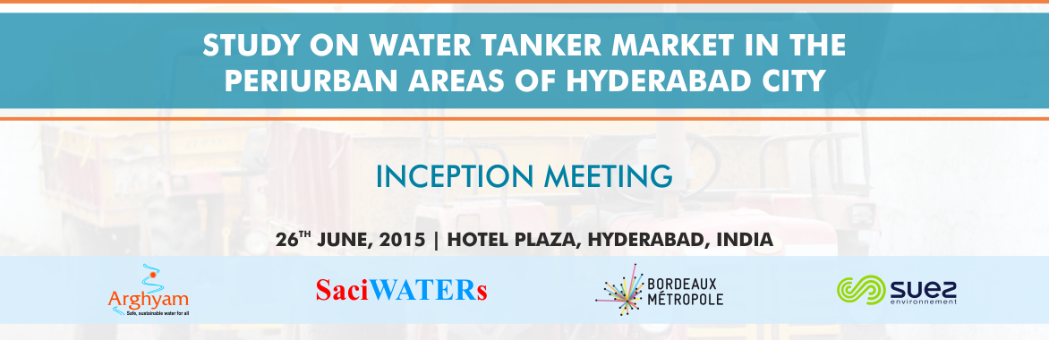
Inception meeting for the Tanker Economy Project is being organised by SaciWATERs on 26th June 2015 at Hotel Plaza, Telangana Tourism Plaza, Begumpet, Hyderabad.
Invitation to 1st Summer School on ‘Small Island Natural Resource Development’ - 17 to 21 August, St. Eustatius, Caribbean Netherlands.
Jun 17 2015 In News summer school Caribbean-Netherlands Science Institute (CNSI) is organising the 1st Summer School devoted to ‘Small Island Natural Resource Development’. The theme of the module for this inaugural summer school programme is ‘Sustainable Coastal Management’ and will take place from 17 to 21 August 2015 at St. Eustatius, Caribbean Netherlands. This module ‘Sustainable Coastal management’ will be presented by experts from the well-known UNESCO-IHE Institute for Water Education (International Partner of Cap-Net UNDP) in cooperation with NIOZ Royal Netherlands Institute for Sea Research and Van Hall Larenstein University of Applied Sciences. read more...